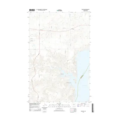
2014 Map of Sanish NW
USGS Topo · Published 2014About this map
Lake Sakakawea and the Missouri River dominate the eastern reaches of this landscape, marking the rugged boundary between McKenzie and Mountrail counties. The terrain is defined by deep incisions like Rough Coulee and Whitebody Coulee, which drain toward the vast reservoir. Further inland, the extractive industrial presence of the Antelope Oil Field occupies the northern uplands, intersected by the primary thoroughfares of ND-23 and Highway 22 N. Local heritage is anchored by the Goodbird Cem near the junction of 39th St NW, while several watercourses including Antelope Cr and Clarks Cr wind through the prairie. The map provides a precise look at the rural road grid and the complex shoreline around Hunts Along Bay as they appeared in the early 21st century.
Find a feature on this map
21 named features on this map. Tap any name to fly to it.
Don’t see what you’re looking for? This feature index may not catch every label — zoom into the map to look around manually.
Map Details
Editions of this 2014 Sanish NW Map
This is the sole edition of this map. No revisions or reprints were ever made.
Other maps of this area

1953 · Williston
USGS Topo · 1:250,000

1953 · Watford City
USGS Topo · 1:250,000

1957 · Williston
USGS Topo · 1:250,000

1957 · Watford City
USGS Topo · 1:250,000

1965 · Charlson
USGS Topo · 1:24,000

1965 · Blue Buttes
USGS Topo · 1:24,000

1965 · Blue Buttes SE
USGS Topo · 1:24,000

1967 · Watford City
USGS Topo · 1:250,000

1967 · Sanish NW
USGS Topo · 1:24,000

1967 · Sanish
USGS Topo · 1:24,000