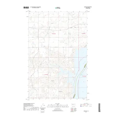
2017 Map of Sanish NW
USGS Topo · Published 2017About this map
Lake Sakakawea dominates the southeastern portion of this map, its shoreline forming deep inlets like Hunts Along Bay. This landscape is defined by the high bluffs overlooking the Missouri River, where the McKenzie Co Mountrail Co boundary follows the modern waterway. The upland areas are marked by a network of drainage systems including Antelope Cr and Clarks Cr, along with distinct topographical features such as Rough Coulee and Whitebody Coulee. Local history is centered on the small family and community burial grounds located north of the lake, including Goodbird Cem, Snowbird Cem, and Matthews Cem. These sites, along with names like Sitting Crow Rd, reflect the cultural heritage of the Fort Berthold area. The map illustrates the contemporary road network, including BIA Rte 2 and Lake Sakakawea Rd, providing access to the rugged Missouri River breaks.
Find a feature on this map
25 named features on this map. Tap any name to fly to it.
Don’t see what you’re looking for? This feature index may not catch every label — zoom into the map to look around manually.
Map Details
Editions of this 2017 Sanish NW Map
This is the sole edition of this map. No revisions or reprints were ever made.
Other maps of this area

1953 · Williston
USGS Topo · 1:250,000

1953 · Watford City
USGS Topo · 1:250,000

1957 · Williston
USGS Topo · 1:250,000

1957 · Watford City
USGS Topo · 1:250,000

1965 · Charlson
USGS Topo · 1:24,000

1965 · Blue Buttes
USGS Topo · 1:24,000

1965 · Blue Buttes SE
USGS Topo · 1:24,000

1967 · Watford City
USGS Topo · 1:250,000

1967 · Sanish NW
USGS Topo · 1:24,000

1967 · Sanish
USGS Topo · 1:24,000