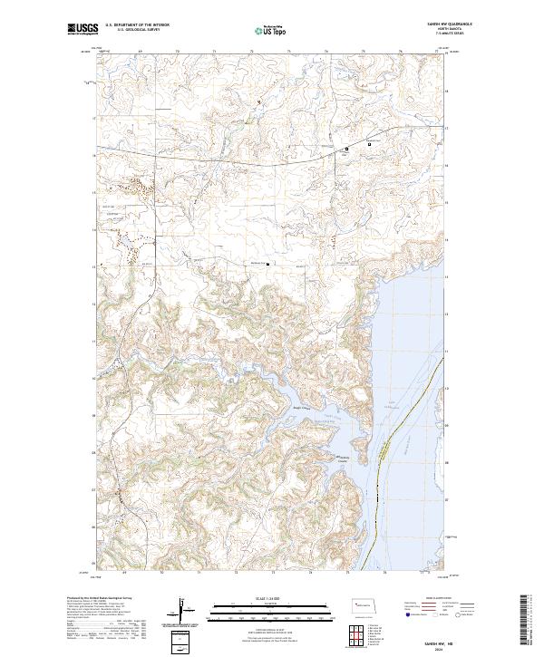
2024 Map of Sanish NW
USGS Topo · Published 2024About this map
Lake Sakakawea and the Missouri River dominate the eastern reaches of this landscape on the boundary between McKenzie and Mountrail counties. The terrain is defined by a network of drainage systems, including Clarks Creek and Rough Coulee, which carve through the plains toward Hunts Along Bay. This modern survey illustrates a quiet, rural area primarily served by Bureau of Indian Affairs routes like BIA Rte 2 and local roads such as Sitting Crow Rd. For genealogists and local historians, the map identifies several family-named burial sites that preserve the area's heritage, including Snowbird Cem, Goodbird Cem, and Matthews Cem. The intricate shoreline and varied elevations around Whitebody Coulee provide a detailed look at the contemporary topography of the Fort Berthold Indian Reservation vicinity.
Find a feature on this map
28 named features on this map. Tap any name to fly to it.
Don’t see what you’re looking for? This feature index may not catch every label — zoom into the map to look around manually.
Map Details
Editions of this 2024 Sanish NW Map
This is the sole edition of this map. No revisions or reprints were ever made.
Other maps of this area

1953 · Williston
USGS Topo · 1:250,000

1953 · Watford City
USGS Topo · 1:250,000

1957 · Williston
USGS Topo · 1:250,000

1957 · Watford City
USGS Topo · 1:250,000

1965 · Charlson
USGS Topo · 1:24,000

1965 · Blue Buttes
USGS Topo · 1:24,000

1965 · Blue Buttes SE
USGS Topo · 1:24,000

1967 · Watford City
USGS Topo · 1:250,000

1967 · Sanish NW
USGS Topo · 1:24,000

1967 · Sanish
USGS Topo · 1:24,000