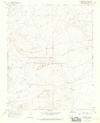
1966 Map of Sanostee East
USGS Topo · Published 1970About this map
The high desert landscape of the Navajo Indian Reservation in San Juan County is defined here by a series of prominent geological formations and the early infrastructure of energy extraction. The map reveals the Tocito Dome Oil Field in the northeast, where pipelines and access roads cut across the arid terrain. Natural water sources are scarce but critical, evidenced by Tocito Springs and the sprawling drainages of Sanostee Wash, Tocito Wash, and Pajarito Creek. Significant topographic landmarks such as the massive Rock Ridge and the isolated Rock Mesa provide clear orientation points across the high-altitude plateau. A single Drill Hole noted in the west suggests the ongoing exploration of the region's mineral wealth during the mid-1960s, while the rugged Porcupine Canyon marks the dramatic relief found in the southern reaches of this Navajo Nation territory.
Find a feature on this map
12 named features on this map. Tap any name to fly to it.
Don’t see what you’re looking for? This feature index may not catch every label — zoom into the map to look around manually.
Map Details
Editions of this 1966 Sanostee East Map
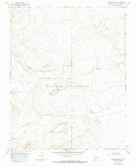
2 editions found
Other maps of this area

1889 · Chaco
USGS Topo · 1:250,000

1892 · Chaco
USGS Topo · 1:250,000

1927 · Sulphur Spring
USGS Topo · 1:96,000

1928 · Kirtland
USGS Topo · 1:125,000

1932 · Kirtland
USGS Topo · 1:125,000

1934 · Ship Rock
USGS Topo · 1:62,500

1937 · Ship Rock
USGS Topo · 1:62,500

1953 · Sanostee
USGS Topo · 1:62,500

1954 · Shiprock
USGS Topo · 1:250,000

1958 · Shiprock
USGS Topo · 1:250,000