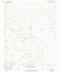
1966 Map of Sanostee East
USGS Topo · Published 1990About this map
The Navajo Indian Reservation landscape around Sanostee is defined by a network of ephemeral drainages and distinct geologic formations within San Juan County. In the mid-1960s, this area supported both traditional settlement and industrial development, centered on the Tocito Dome Oil Field and various Well sites. The terrain is marked by prominent features like Rock Ridge and Rock Mesa, which rise above the primary watercourses of Sanostee Wash and Tocito Wash. Near the community of Tocito, the presence of Tocito Springs suggests a vital local water source in an otherwise arid environment. This survey captures the infrastructure of the era, including a major Pipeline and localized development such as a Drill Hole and several dispersed dwellings, reflecting the coordination of mineral extraction with reservation life.
Find a feature on this map
16 named features on this map. Tap any name to fly to it.
Don’t see what you’re looking for? This feature index may not catch every label — zoom into the map to look around manually.
Map Details
Editions of this 1966 Sanostee East Map
2 editions found
Other maps of this area

1889 · Chaco
USGS Topo · 1:250,000

1892 · Chaco
USGS Topo · 1:250,000

1927 · Sulphur Spring
USGS Topo · 1:96,000

1928 · Kirtland
USGS Topo · 1:125,000

1932 · Kirtland
USGS Topo · 1:125,000

1934 · Ship Rock
USGS Topo · 1:62,500

1937 · Ship Rock
USGS Topo · 1:62,500

1953 · Sanostee
USGS Topo · 1:62,500

1954 · Shiprock
USGS Topo · 1:250,000

1958 · Shiprock
USGS Topo · 1:250,000