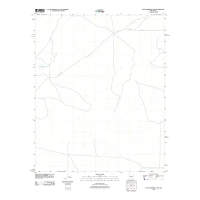
2010 Map of Santa Barbara Lake
USGS Topo · Published 2010About this map
Santa Barbara Lake sits as the central geographic focal point in this high-plains landscape of Torrance County during the early 21st century. The map reveals a sparse network of infrastructure defined primarily by regional transit corridors, including County RD-C076 and County RD-4. These routes trace the natural contours of the basin, illustrating the rural character of the New Mexico interior where water features like the lake dictate the placement of roads and early settlement patterns. Researchers can trace the specific path of County RD-4FG and County RD-C078 as they intersect this arid terrain, providing a look at the land division and transportation layout prior to more modern developments.
Find a feature on this map
5 named features on this map. Tap any name to fly to it.
Don’t see what you’re looking for? This feature index may not catch every label — zoom into the map to look around manually.
Map Details
Editions of this 2010 Santa Barbara Lake Map
This is the sole edition of this map. No revisions or reprints were ever made.
Other maps of this area

1954 · Fort Sumner
USGS Topo · 1:250,000

1958 · Fort Sumner
USGS Topo · 1:250,000
1978 · George Ranch
USGS Topo · 1:24,000

1978 · Mesa Leon
USGS Topo · 1:24,000

1978 · Santa Barbara Lake
USGS Topo · 1:24,000

1978 · Vaughn
USGS Topo · 1:24,000

1978 · Tejon
USGS Topo · 1:24,000

1978 · Santo Nino Canyon
USGS Topo · 1:24,000

1978 · Encino
USGS Topo · 1:24,000

1978 · Dunlap Ranch
USGS Topo · 1:24,000