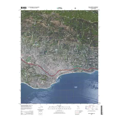
2015 Map of Santa Barbara
USGS Topo · Published 2015About this map
Santa Barbara and the wealthy enclave of Montecito sit at the foot of the Santa Ynez Mountains in this modern survey. The coastal geography is defined by a series of south-flowing drainages including Mission Creek, Sycamore Creek, and Arroyo Burro. The landscape transitions abruptly from the dense urban grid and institutional campuses like Westmont College and Antioch University Santa Barbara to the protected wilderness of the Los Padres National Forest. High peaks such as La Cumbre Peak and Montecito Peak overlook the shoreline, where prominent points like Point Castillo and Edgecliff Point frame the city's famous beaches. Infrastructure such as the Santa Barbara Water Tunnel and reservoirs like Sheffield Reservoir indicate the complex water management required for this Mediterranean climate.
Find a feature on this map
210 named features on this map. Tap any name to fly to it.
Don’t see what you’re looking for? This feature index may not catch every label — zoom into the map to look around manually.
Map Details
Editions of this 2015 Santa Barbara Map
This is the sole edition of this map. No revisions or reprints were ever made.
Other maps of this area

1902 · Santa Ynez
USGS Topo · 1:125,000

1905 · Santa Ynez
USGS Topo · 1:125,000

1941 · San Rafael Mtn.
USGS Topo · 1:62,500

1942 · Goleta
USGS Topo · 1:62,500

1942 · San Rafael Mtn.
USGS Topo · 1:62,500

1942 · Little Pine Mountain
USGS Topo · 1:24,000

1943 · San Rafael Mtn.
USGS Topo · 1:62,500

1943 · Hildreth Peak
USGS Topo · 1:24,000

1944 · Santa Barbara
USGS Topo · 1:31,680
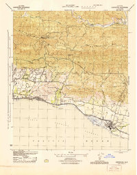
1944 · Carpinteria
USGS Topo · 1:31,680
Featured Places
- Santa Barbara, CA
- Montecito, CA
- Mission Canyon, CA
- Las Positas Meadows, Santa Barbara
- Vista Del Monte, Santa Barbara