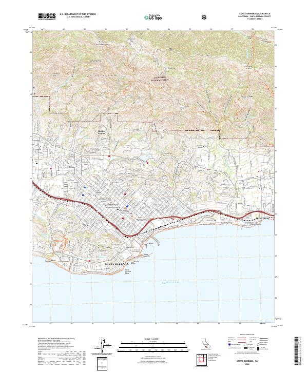
2022 Map of Santa Barbara
USGS Topo · Published 2022About this map
Santa Barbara sits at the foot of the Santa Ynez Mountains, where the coastal plain meets the Pacific Ocean. This 2022 survey documents the modern layout of the city, showing the density of residential neighborhoods like Mission Canyon and La Mesa alongside significant institutional campuses including Santa Barbara City College and Westmont College. The transport network is defined by the Southern Pacific rail line and the historic Stearns Wharf, a focal point of the shoreline.
Find a feature on this map
272 named features on this map. Tap any name to fly to it.
Don’t see what you’re looking for? This feature index may not catch every label — zoom into the map to look around manually.
Map Details
Editions of this 2022 Santa Barbara Map
This is the sole edition of this map. No revisions or reprints were ever made.
Other maps of this area

1902 · Santa Ynez
USGS Topo · 1:125,000

1905 · Santa Ynez
USGS Topo · 1:125,000

1941 · San Rafael Mtn.
USGS Topo · 1:62,500

1942 · Goleta
USGS Topo · 1:62,500

1942 · San Rafael Mtn.
USGS Topo · 1:62,500

1942 · Little Pine Mountain
USGS Topo · 1:24,000

1943 · San Rafael Mtn.
USGS Topo · 1:62,500

1943 · Hildreth Peak
USGS Topo · 1:24,000

1944 · Santa Barbara
USGS Topo · 1:31,680
1944 · Carpinteria
USGS Topo · 1:31,680
Featured Places
- Santa Barbara, CA
- Montecito, CA
- Mission Canyon, CA
- Vista Del Monte, Santa Barbara
- Las Positas Meadows, Santa Barbara