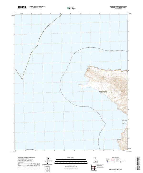
2021 Map of Santa Cruz Island A
USGS Topo · Published 2021About this map
The westernmost peninsula of Santa Cruz Island, part of Channel Islands National Park, is detailed in this 2021 survey. This coastal landscape is defined by its series of prominent geographical markers, from West Point and Fraser Point in the north to Black Point and Kinton Point along the western edge. The terrain reflects the unique topography of the Northern Channel Islands, where inland canyons like Cañada Cervada and Cañada De Los Sauces meet the sea. The map also delineates the interface between the rugged shoreline and the Pacific Ocean, notably at the protected waters of Forney Cove. This sheet serves as a clear record of the island's conservation boundary and its geological features, including the small stretch of coastline at Christi Beach.
Find a feature on this map
10 named features on this map. Tap any name to fly to it.
Don’t see what you’re looking for? This feature index may not catch every label — zoom into the map to look around manually.
Map Details
Editions of this 2021 Santa Cruz Island A Map
This is the sole edition of this map. No revisions or reprints were ever made.
Other maps of this area
1943 · Santa Rosa Island East
USGS Topo · 1:24,000
1943 · Santa Cruz Island A
USGS Topo · 1:24,000

1948 · Santa Maria
USGS Topo · 1:250,000

1949 · Los Angeles
USGS Topo · 1:250,000

1949 · Long Beach
USGS Topo · 1:250,000

1955 · Los Angeles
USGS Topo · 1:250,000

1956 · Santa Maria
USGS Topo · 1:250,000

1957 · Long Beach
USGS Topo · 1:250,000

1957 · Santa Maria
USGS Topo · 1:250,000

1958 · Santa Maria
USGS Topo · 1:250,000