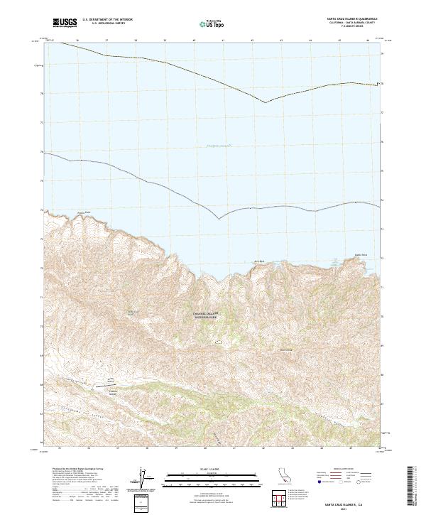
2021 Map of Santa Cruz Island B
USGS Topo · Published 2021About this map
Santa Cruz Island and the protected lands of Channel Islands National Park dominate this topographic study, showcasing the island's complex drainage systems and coastal interface. High points like Devils Peak rise above the internal Central Valley, which channels runoff toward the western shore. The map details the transition from steep coastal cliffs at Profile Point and Diablo Point to the small, protected inlets of Ladys Harbor and Frys Harbor along the northern coast. Modern infrastructure is limited to the remote Christy Airstrip, while the landscape is defined by deep cuts such as Cañada De Los Sauces and Laguna Canyon, illustrating the erosional forces that have shaped this maritime environment.
Find a feature on this map
15 named features on this map. Tap any name to fly to it.
Don’t see what you’re looking for? This feature index may not catch every label — zoom into the map to look around manually.
Map Details
Editions of this 2021 Santa Cruz Island B Map
This is the sole edition of this map. No revisions or reprints were ever made.
Other maps of this area
1943 · Santa Cruz Island A
USGS Topo · 1:24,000
1943 · Santa Cruz Island B
USGS Topo · 1:24,000

1949 · Los Angeles
USGS Topo · 1:250,000

1949 · Long Beach
USGS Topo · 1:250,000

1955 · Los Angeles
USGS Topo · 1:250,000

1957 · Long Beach
USGS Topo · 1:250,000

1958 · Long Beach
USGS Topo · 1:250,000

1959 · Los Angeles
USGS Topo · 1:250,000

1960 · Long Beach
USGS Topo · 1:250,000

1966 · Los Angeles
USGS Topo · 1:250,000