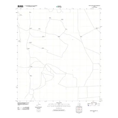
2010 Map of Santa Elena NW
USGS Topo · Published 2010About this map
Windmill-driven water infrastructure defines the character of this Jim Hogg County landscape, reflecting the essential role of groundwater in sustaining cattle ranching across South Texas. Named landmarks such as Alta Vista Windmill and Agua Dulce Windmill are scattered throughout the territory, linked by a sparse network of ranch roads and tracks. These features, including San Pedro Windmill and Huisache Windmill, serve as primary points of orientation and historical continuity for local landholders. The presence of numerous named wells like Bonita Windmill and El Jardin Windmill suggests a long-standing reliance on the underlying aquifer to manage this semi-arid environment. The U.S. Geological Survey documented these specific markers, which remain vital for identifying property lines and historical grazing patterns in a region where large-scale ranching is the primary land use.
Find a feature on this map
17 named features on this map. Tap any name to fly to it.
Don’t see what you’re looking for? This feature index may not catch every label — zoom into the map to look around manually.
Map Details
Editions of this 2010 Santa Elena NW Map
This is the sole edition of this map. No revisions or reprints were ever made.
Other maps of this area

1921 · Falfurrias
USGS Topo · 1:125,000

1938 · Agua Nueva
USGS Topo · 1:62,500

1939 · Encantada
USGS Topo · 1:62,500

1949 · Mc Allen
USGS Topo · 1:250,000

1954 · McAllen
USGS Topo · 1:250,000

1956 · Laredo
USGS Topo · 1:250,000

1957 · Mc Allen
USGS Topo · 1:250,000

1962 · McAllen
USGS Topo · 1:250,000

1968 · Palomas Ranch SW
USGS Topo · 1:24,000

1968 · Palomas Ranch SE
USGS Topo · 1:24,000