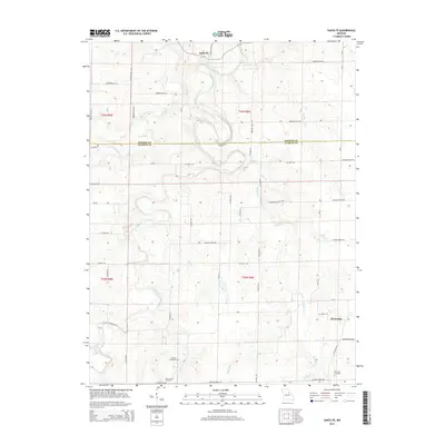
2014 Map of Santa Fe
USGS Topo · Published 2014About this map
Santa Fe sits at the northern edge of this landscape where the South Fork Salt River and Elm Br converge. The terrain is defined by a dense network of tributaries, including Youngs Cr, Talleys Br, and Littleby Cr, which carve through the farmland of the Monroe and Audrain county line. These watercourses historically dictated the placement of early settlements and rural cemeteries, which remain key markers of the area's genealogical heritage.
Find a feature on this map
54 named features on this map. Tap any name to fly to it.
Don’t see what you’re looking for? This feature index may not catch every label — zoom into the map to look around manually.
Map Details
Editions of this 2014 Santa Fe Map
This is the sole edition of this map. No revisions or reprints were ever made.
Other maps of this area

1890 · Mexico
USGS Topo · 1:125,000

1932 · Mexico
USGS Topo · 1:62,500

1942 · Wellsville
USGS Topo · 1:62,500

1945 · Florida
USGS Topo · 1:62,500

1945 · Perry
USGS Topo · 1:62,500

1948 · Quincy
USGS Topo · 1:250,000

1956 · Quincy
USGS Topo · 1:250,000
1972 · Mexico East
USGS Topo · 1:24,000
1972 · Molino
USGS Topo · 1:24,000
1972 · Santa Fe
USGS Topo · 1:24,000