
1954 Map of Santa Fe
USGS Topo · Published 1963About this map
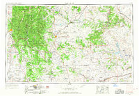
The Sangre de Cristo Mountains dominate the western landscape of this mid-century survey, rising above Santa Fe and the expansive Santa Fe National Forest. This region preserves a complex network of early high-altitude settlements and land grants, where the Mora River and Pecos River define the local geography. To the east, the terrain transitions into the high plains and mesas, including Yegua Mesa and Mesa Montosa, before reaching the Canadian River and Conchas Reservoir.
Find a feature on this map
98 named features on this map. Tap any name to fly to it.
Don’t see what you’re looking for? This feature index may not catch every label — zoom into the map to look around manually.
Map Details
Editions of this 1954 Santa Fe Map
4 editions found
Other maps of this area

1889 · Las Vegas
USGS Topo · 1:125,000

1889 · Santa Fe
USGS Topo · 1:125,000

1890 · Bernal
USGS Topo · 1:125,000

1891 · Bernal
USGS Topo · 1:125,000

1891 · Las Vegas
USGS Topo · 1:125,000

1892 · San Pedro
USGS Topo · 1:125,000

1892 · Santa Clara
USGS Topo · 1:125,000

1892 · Watrous
USGS Topo · 1:125,000

1892 · Corazon
USGS Topo · 1:125,000

1893 · Las Vegas
USGS Topo · 1:125,000