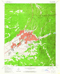
1961 Map of Santa Fe
USGS Topo · Published 1964About this map
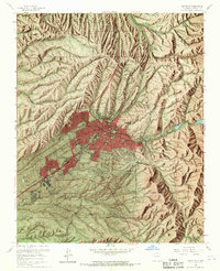
Santa Fe spreads across the high desert floor at the base of the Sangre de Cristo foothills, its mid-century growth visible through residential expansion toward Larragoite and the US Indian School. The city’s complex irrigation heritage is preserved in the Acequia Madre, which parallels the Santa Fe River through the historic heart of town. Institutional landmarks like the State Capitol and St Michaels College anchor the urban grid, while the Atchison Topeka and Santa Fe railroad serves the industrial and transport needs of the state capital. Beyond the developed center, the landscape is defined by traditional land grants such as the Juan de Gabaldon Grant and a dense network of seasonal drainages, including the Arroyo de los Chamisos and Arroyo de la Barranca. Culturally significant sites like the Navajo Museum of Ceremonial Art and Bishops Lodge highlight the area's transition into a center for tourism and arts.
Find a feature on this map
92 named features on this map. Tap any name to fly to it.
Don’t see what you’re looking for? This feature index may not catch every label — zoom into the map to look around manually.
Map Details
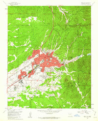
Editions of this 1961 Santa Fe Map
6 editions found
Other maps of this area

1889 · Santa Fe
USGS Topo · 1:125,000

1892 · Santa Clara
USGS Topo · 1:125,000

1894 · Santa Fe
USGS Topo · 1:125,000

1951 · Agua Fria
USGS Topo · 1:24,000

1951 · Turquoise Hill
USGS Topo · 1:24,000

1952 · Santa Fe
USGS Topo · 1:24,000

1952 · Turquoise Hill
USGS Topo · 1:24,000

1952 · Seton Village
USGS Topo · 1:24,000

1953 · Tesuque
USGS Topo · 1:24,000

1953 · Horcado Ranch
USGS Topo · 1:24,000