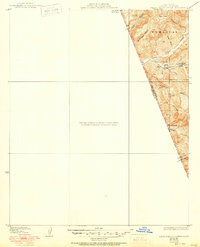
1935 Map of Santa Felicia Canyon
USGS Topo · Published 1950About this map
The canyons of the Angeles Nat For border and the Ventura County line define this rugged portion of Southern California as it appeared in the mid-20th century. This specific quadrangle fragment focuses on the eastern edge of the Santa Felicia watershed, where remote homesteads such as Temascal Ranch, Lechler Ranch, and Black Ranch were established in the narrow valleys. The presence of Oil Wells and Tanks near the head of Santa Felicia Canyon signals the region's industrial utility during the post-war era.
Find a feature on this map
23 named features on this map. Tap any name to fly to it.
Don’t see what you’re looking for? This feature index may not catch every label — zoom into the map to look around manually.
Map Details
Editions of this 1935 Santa Felicia Canyon Map
3 editions found
Other maps of this area

1900 · Piru
USGS Topo · 1:62,500

1903 · Tejon
USGS Topo · 1:125,000

1903 · Camulos
USGS Topo · 1:125,000

1903 · Santa Susana
USGS Topo · 1:62,500

1921 · Piru
USGS Topo · 1:62,500
1929 · Pico
USGS Topo · 1:24,000

1931 · Whitaker Peak
USGS Topo · 1:24,000

1931 · Santa Felicia Canyon
USGS Topo · 1:24,000

1931 · Castaic
USGS Topo · 1:24,000

1935 · Santa Felicia Canyon
USGS Topo · 1:24,000