
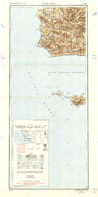
1948 Map of Santa Maria
USGS Topo · Published 1948About this map
Santa Maria and the surrounding central coast valleys are captured here in the late 1940s, a period of transition from wartime military footprints to postwar agricultural and industrial expansion. The massive Camp Cooke Military Reservation dominates the coastline between Purisima Point and Point Arguello, while the Southern Pacific railroad corridor links coastal stops like Surf and Tangair to the interior hubs of Lompoc and Guadalupe.
Find a feature on this map
68 named features on this map. Tap any name to fly to it.
Don’t see what you’re looking for? This feature index may not catch every label — zoom into the map to look around manually.
Map Details
Editions of this 1948 Santa Maria Map
2 editions found
Other maps of this area

1897 · Port Harford
USGS Topo · 1:62,500

1897 · Arroyo Grande
USGS Topo · 1:62,500

1900 · San Luis
USGS Topo · 1:125,000

1902 · Santa Ynez
USGS Topo · 1:125,000

1905 · Guadalupe
USGS Topo · 1:125,000

1905 · Santa Ynez
USGS Topo · 1:125,000

1905 · Lompoc
USGS Topo · 1:125,000

1912 · McKittrick
USGS Topo · 1:125,000

1922 · Nipomo
USGS Topo · 1:62,500

1937 · Branch Mtn
USGS Topo · 1:48,000