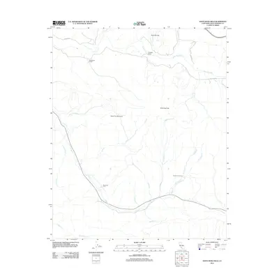
2012 Map of Santa Rosa Hills
USGS Topo · Published 2012About this map
Rancho San Julian and Rancho de los Llanitos reflect the enduring legacy of the ranching era within the central coastal ranges. This landscape is defined by the high ridges of the Santa Rosa Hills and the southern reach of the Santa Ynez Mountains, where the drainage patterns of numerous creeks like El Jaro Cr, Ytias Cr, and Alamo Cr carve through the terrain. The northern boundary is shaped by the Santa Ynez River, which passes through the Lompoc Valley and beneath the Santa Rita Hills. The topography illustrates a complex network of canyons and arroyos, such as Arroyo El Bulito and Gaviolito Cr, which descend from the highlands toward the coastal plain. Rural access is maintained via historically-rooted routes like Sweeney Rd and Santa Rosa Rd.
Find a feature on this map
25 named features on this map. Tap any name to fly to it.
Don’t see what you’re looking for? This feature index may not catch every label — zoom into the map to look around manually.
Map Details
Editions of this 2012 Santa Rosa Hills Map
This is the sole edition of this map. No revisions or reprints were ever made.
Other maps of this area

1905 · Lompoc
USGS Topo · 1:125,000

1942 · Lompoc
USGS Topo · 1:125,000

1942 · Lompoc
USGS Topo · 1:62,500

1942 · Pt. Conception
USGS Topo · 1:62,500

1942 · Gaviota
USGS Topo · 1:62,500

1942 · Los Olivos
USGS Topo · 1:62,500

1943 · Los Olivos
USGS Topo · 1:62,500

1943 · Lompoc
USGS Topo · 1:125,000

1943 · Gaviota
USGS Topo · 1:62,500

1947 · Lompoc
USGS Topo · 1:24,000