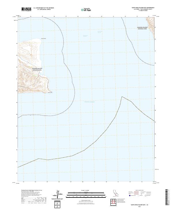
2021 Map of Santa Rosa Island East
USGS Topo · Published 2021About this map
Channel Islands National Park encompasses the rugged eastern coastline of Santa Rosa Island, where the land meets the Pacific Ocean at prominent landforms like Skunk Point and East Point. This coastal landscape is defined by its isolation and maritime geography, with the Santa Cruz Channel separating this island from its neighbors. Primitive tracks, including the Sierra Pablo Road Trl and East Point Road Trl, provide the only terrestrial access through the island's interior to the eastern shoreline. The map documents the intricate coastline and bathymetric contours of the surrounding waters as they appeared in the early 21st century, serving as a primary reference for the physical geography of this protected marine and island environment.
Find a feature on this map
7 named features on this map. Tap any name to fly to it.
Don’t see what you’re looking for? This feature index may not catch every label — zoom into the map to look around manually.
Map Details
Editions of this 2021 Santa Rosa Island East Map
This is the sole edition of this map. No revisions or reprints were ever made.
Other maps of this area
1943 · Santa Rosa Island East
USGS Topo · 1:24,000
1943 · Santa Cruz Island A
USGS Topo · 1:24,000

1948 · Santa Maria
USGS Topo · 1:250,000

1949 · Los Angeles
USGS Topo · 1:250,000

1949 · Long Beach
USGS Topo · 1:250,000

1955 · Los Angeles
USGS Topo · 1:250,000

1956 · Santa Maria
USGS Topo · 1:250,000

1957 · Long Beach
USGS Topo · 1:250,000

1957 · Santa Maria
USGS Topo · 1:250,000

1958 · Santa Maria
USGS Topo · 1:250,000