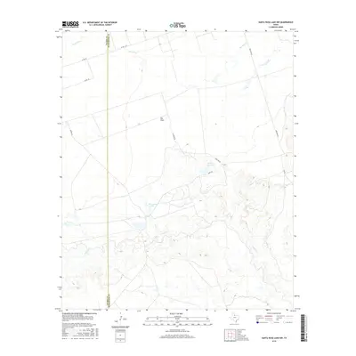
2016 Map of Santa Rosa Lake NW
USGS Topo · Published 2016About this map
The border between Foard Co and Wilbarger Co divides this rural Texas landscape, characterized by cattle ranching and sparse water resources. The terrain is marked by seasonal drainages such as Beaver Cr and Paradise Cr, which feed local water storage including Hart Camp Lake and Bitch Cr Reservoir. These small reservoirs were essential for supporting livestock and agriculture in an arid environment. The road network, including Iron Pens Rd, Harts Rd, and Gin Rd, suggests a landscape organized around functional agricultural infrastructure and land management. Large tracts of open ground like Big Field dominate the central portion of the survey, illustrating the vast scale of landholdings in North Texas. The presence of Elevator Rd further points toward the local grain and storage economy that connects these remote fields to regional markets.
Find a feature on this map
14 named features on this map. Tap any name to fly to it.
Don’t see what you’re looking for? This feature index may not catch every label — zoom into the map to look around manually.
Map Details
Editions of this 2016 Santa Rosa Lake NW Map
This is the sole edition of this map. No revisions or reprints were ever made.
Other maps of this area

1954 · Wichita Falls
USGS Topo · 1:250,000

1955 · Lawton
USGS Topo · 1:250,000

1958 · Wichita Falls
USGS Topo · 1:250,000

1958 · Vernon
USGS Topo · 1:62,500

1958 · Medicine Mound
USGS Topo · 1:62,500

1966 · Santa Rosa Lake
USGS Topo · 1:24,000

1966 · Santa Rosa Lake SW
USGS Topo · 1:24,000

1966 · Colwell Creek
USGS Topo · 1:24,000

1966 · Northwest Lake Kemp
USGS Topo · 1:24,000

1966 · Thalia
USGS Topo · 1:24,000