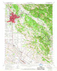
1954 Map of Santa Rosa
USGS Topo · Published 1968About this map
Santa Rosa serves as the bustling hub of this mid-century survey, shown just as post-war development began to reach into the surrounding valleys. The city's core is densely detailed, featuring Santa Rosa Jr College and several schools like Roseland School, while the outlying landscape remains a mix of agriculture and open space. To the southeast, the Sonoma State Home and the sprawling Jack London Ranch highlight the unique institutional and cultural history of the Glen Ellen area.
Find a feature on this map
99 named features on this map. Tap any name to fly to it.
Don’t see what you’re looking for? This feature index may not catch every label — zoom into the map to look around manually.
Map Details
Editions of this 1954 Santa Rosa Map
2 editions found
Other maps of this area

1902 · Napa
USGS Topo · 1:125,000

1914 · Petaluma
USGS Topo · 1:62,500

1916 · Mare Island
USGS Topo · 1:62,500

1916 · Santa Rosa
USGS Topo · 1:62,500

1916 · Point Reyes
USGS Topo · 1:48,000

1918 · Point Reyes
USGS Topo · 1:62,500

1920 · Healdsburg
USGS Topo · 1:62,500

1927 · Calistoga
USGS Topo · 1:62,500

1933 · Healdsburg
USGS Topo · 1:48,000

1935 · Sebastopol
USGS Topo · 1:48,000