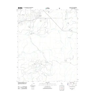
2012 Map of Santa Ynez
USGS Topo · Published 2012About this map
The Santa Ynez Valley is the primary focus of this 2012 topographic record, showing a landscape defined by traditional ranching operations and a burgeoning viticulture industry. The area around Solvang and the Santa Ynez PO contains numerous agricultural and residential developments, including The Gainey Vineyard and the Santa Ynez Valley Winery. Water resources are well-documented, with the Santa Ynez River cutting through the center of the sheet, supported by a network of seasonal drainages like Alamo Pintado Cr and Santa Agueda Cr.
Find a feature on this map
49 named features on this map. Tap any name to fly to it.
Don’t see what you’re looking for? This feature index may not catch every label — zoom into the map to look around manually.
Map Details
Editions of this 2012 Santa Ynez Map
This is the sole edition of this map. No revisions or reprints were ever made.
Other maps of this area

1902 · Santa Ynez
USGS Topo · 1:125,000

1905 · Santa Ynez
USGS Topo · 1:125,000

1905 · Lompoc
USGS Topo · 1:125,000

1941 · San Rafael Mtn.
USGS Topo · 1:62,500

1942 · Lompoc
USGS Topo · 1:125,000

1942 · Gaviota
USGS Topo · 1:62,500

1942 · Goleta
USGS Topo · 1:62,500

1942 · San Rafael Mtn.
USGS Topo · 1:62,500

1942 · Los Olivos
USGS Topo · 1:62,500

1943 · San Rafael Mtn.
USGS Topo · 1:62,500