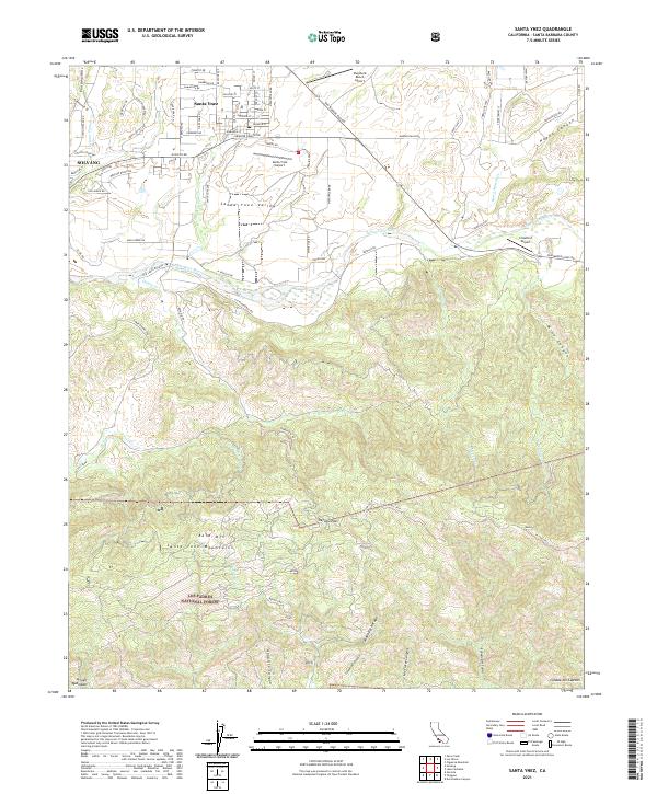
2021 Map of Santa Ynez
USGS Topo · Published 2021About this map
Santa Ynez Valley is the focal point of this 2021 study, where the developed grids of Solvang and Santa Ynez meet the transition to the steep southern slopes of the Santa Ynez Mountains. The Santa Ynez River carves through the center of the sheet, flanked by numerous small airfields including Santa Ynez Airport and Crawford Airport, reflecting the region's aviation and equestrian character. South of the river, the land rises sharply into the Los Padres National Forest, a wilderness of deep drainage canyons like Cañada Del Refugio and Las Flores Canyon. Historic transit routes are evident in Refugio Pass, which provides a topographical break in the ridge line near Bald Mtn. Local road names like Armour Ranch Rd and Count Fleet St underscore the deep agricultural and thoroughbred horse racing heritage that defines this corner of Santa Barbara County.
Find a feature on this map
88 named features on this map. Tap any name to fly to it.
Don’t see what you’re looking for? This feature index may not catch every label — zoom into the map to look around manually.
Map Details
Editions of this 2021 Santa Ynez Map
This is the sole edition of this map. No revisions or reprints were ever made.
Other maps of this area

1902 · Santa Ynez
USGS Topo · 1:125,000

1905 · Santa Ynez
USGS Topo · 1:125,000

1905 · Lompoc
USGS Topo · 1:125,000

1941 · San Rafael Mtn.
USGS Topo · 1:62,500

1942 · Lompoc
USGS Topo · 1:125,000

1942 · Gaviota
USGS Topo · 1:62,500

1942 · Goleta
USGS Topo · 1:62,500

1942 · San Rafael Mtn.
USGS Topo · 1:62,500

1942 · Los Olivos
USGS Topo · 1:62,500

1943 · San Rafael Mtn.
USGS Topo · 1:62,500