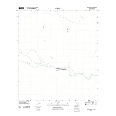
2011 Map of Santana Mesa
USGS Topo · Published 2011About this map
Rio Grande defines the international boundary between the United States and Mexico in this high-desert landscape. The terrain is marked by significant topographical shifts, most notably the prominent Santana Mesa which rises above the surrounding flats. Steep-walled drainages such as Canyon Colorado and Canyon Madera carve through the earth, channeling intermittent water toward the river valley. Transportation in this desolate stretch of Presidio County is limited to FM 170, which follows the contours of the river. Small, isolated water sources like Seep Spring and Trough Spring are vital landmarks in an otherwise arid environment, while Panther Creek and Arroyo Primero represent the primary natural drainage network for the northern reaches of the quadrangle.
Find a feature on this map
12 named features on this map. Tap any name to fly to it.
Don’t see what you’re looking for? This feature index may not catch every label — zoom into the map to look around manually.
Map Details
Editions of this 2011 Santana Mesa Map
This is the sole edition of this map. No revisions or reprints were ever made.
Other maps of this area

1896 · Polvo
USGS Topo · 1:125,000

1903 · Terlingua
USGS Topo · 1:125,000

1904 · Terlingua
USGS Topo · 1:125,000

1931 · Lajitas
USGS Topo · 1:62,500

1959 · Emory Peak
USGS Topo · 1:250,000

1959 · Presidio
USGS Topo · 1:250,000

1965 · Presidio
USGS Topo · 1:250,000

1965 · Emory Peak
USGS Topo · 1:250,000
1971 · Redford SE
USGS Topo · 1:24,000
1971 · The Solitario
USGS Topo · 1:24,000