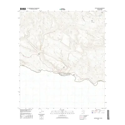
2016 Map of Santana Mesa
USGS Topo · Published 2016About this map
The Rio Grande serves as the international boundary between Texas and Estados Unidos Mexicanos in this 2016 survey of the Big Bend region. The landscape is dominated by the massive Santana Mesa and a complex network of drainage systems including Panther Canyon and Canyon Madera. This desert terrain, characterized by deep incisions and high relief, is accessible primarily via FM 170, which follows the river's northern bank.
Find a feature on this map
18 named features on this map. Tap any name to fly to it.
Don’t see what you’re looking for? This feature index may not catch every label — zoom into the map to look around manually.
Map Details
Editions of this 2016 Santana Mesa Map
This is the sole edition of this map. No revisions or reprints were ever made.
Other maps of this area

1896 · Polvo
USGS Topo · 1:125,000

1903 · Terlingua
USGS Topo · 1:125,000

1904 · Terlingua
USGS Topo · 1:125,000

1931 · Lajitas
USGS Topo · 1:62,500

1959 · Emory Peak
USGS Topo · 1:250,000

1959 · Presidio
USGS Topo · 1:250,000

1965 · Presidio
USGS Topo · 1:250,000

1965 · Emory Peak
USGS Topo · 1:250,000
1971 · Redford SE
USGS Topo · 1:24,000
1971 · The Solitario
USGS Topo · 1:24,000