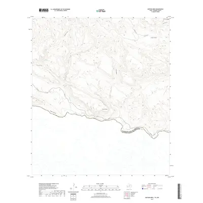
2019 Map of Santana Mesa
USGS Topo · Published 2019About this map
Santana Mesa dominates the northern bank of the Rio Grande in this isolated reach of Presidio County, marking the international border between the United States and Mexico. The landscape is defined by deep incisions like Canyon Colorado and Canyon Madera, which drain toward the river through an arid, high-desert environment. Human presence is concentrated along the river corridor via FM 170, while the interior remains accessible primarily through routes like the Rancherias Loop.
Find a feature on this map
13 named features on this map. Tap any name to fly to it.
Don’t see what you’re looking for? This feature index may not catch every label — zoom into the map to look around manually.
Map Details
Editions of this 2019 Santana Mesa Map
This is the sole edition of this map. No revisions or reprints were ever made.
Other maps of this area

1896 · Polvo
USGS Topo · 1:125,000

1903 · Terlingua
USGS Topo · 1:125,000

1904 · Terlingua
USGS Topo · 1:125,000

1931 · Lajitas
USGS Topo · 1:62,500

1959 · Emory Peak
USGS Topo · 1:250,000

1959 · Presidio
USGS Topo · 1:250,000

1965 · Presidio
USGS Topo · 1:250,000

1965 · Emory Peak
USGS Topo · 1:250,000
1971 · Redford SE
USGS Topo · 1:24,000
1971 · The Solitario
USGS Topo · 1:24,000