
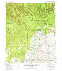
1953 Map of Santo Domingo Pueblo
USGS Topo · Published 1958About this map
Santo Domingo Pueblo Grant and the Pueblo de Cochiti Grant anchor this mid-century view of the Rio Grande valley, where traditional land grants meet modern infrastructure. The Rio Grande flows southward through the center of the sheet, fed by the Santa Fe River and Galisteo Creek. The landscape transitions from the agricultural valley floor near Pena Blanca to the high plateaus of Bland Mesa and Cochiti Mesa.
Find a feature on this map
43 named features on this map. Tap any name to fly to it.
Don’t see what you’re looking for? This feature index may not catch every label — zoom into the map to look around manually.
Map Details
Editions of this 1953 Santo Domingo Pueblo Map
2 editions found
Other maps of this area

1888 · Bernalillo
USGS Topo · 1:125,000

1889 · Albuquerque
USGS Topo · 1:125,000

1890 · Jemes
USGS Topo · 1:125,000

1892 · San Pedro
USGS Topo · 1:125,000

1892 · Jemes
USGS Topo · 1:125,000

1892 · Santa Clara
USGS Topo · 1:125,000

1893 · Albuquerque
USGS Topo · 1:125,000

1937 · Jemez Springs
USGS Topo · 1:48,000

1943 · Jemez
USGS Topo · 1:62,500

1944 · Jemez Springs
USGS Topo · 1:62,500