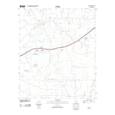
2010 Map of Santo
USGS Topo · Published 2010About this map
Santo serves as the primary northern settlement in this landscape of the Texas Cross Timbers, situated along the upper reaches of Big Sunday Creek. The topography is defined by significant elevations such as Turkey Peak and Bugle Mountain, with drainage provided by the winding courses of Palo Pinto Creek and Buck Creek. Local infrastructure is marked by a high density of small-scale water management, evidenced by numerous structures like E J Porter Lake Dam, Lawrence Porter Lake Number 2 Dam, and Richards Lake Number 3 Dam.
Find a feature on this map
43 named features on this map. Tap any name to fly to it.
Don’t see what you’re looking for? This feature index may not catch every label — zoom into the map to look around manually.
Map Details
Editions of this 2010 Santo Map
This is the sole edition of this map. No revisions or reprints were ever made.
Other maps of this area

1890 · Stephenville
USGS Topo · 1:125,000

1891 · Palo Pinto
USGS Topo · 1:125,000

1918 · Palo Pinto
USGS Topo · 1:125,000

1920 · Stephenville
USGS Topo · 1:125,000

1925 · Palo Pinto 4-b
USGS Topo · 1:48,000

1931 · Santo
USGS Topo · 1:62,500

1954 · Abilene
USGS Topo · 1:250,000

1958 · Abilene
USGS Topo · 1:250,000
1959 · Lipan
USGS Topo · 1:62,500

1959 · Gordon
USGS Topo · 1:62,500