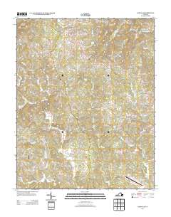
2013 Map of Sanville
USGS Topo · Published 2013About this map
The N Mayo River and its numerous tributaries, including Koger Cr and Bull Run, define the rural geography of this Henry County landscape. In the early 21st century, several small community hubs persist along the local road network, such as Sanville, Blackberry, and Stones Store. The area is characterized by a mix of agricultural clearings and forested ridges, rising to Hogpen Mountain in the northwest corner. Aviation activity is noted at the Trent Farm Airstrip and the Blue Ridge Airport near the southern boundary. Local family names are reflected in landmarks like Pannill Fork and Dillons Fork, while the community of Stella sits near the confluence of Mill Cr and the river. This documentation provides a clear view of the modern rural infrastructure and watercourses before further regional development.
Find a feature on this map
149 named features on this map. Tap any name to fly to it.
Don’t see what you’re looking for? This feature index may not catch every label — zoom into the map to look around manually.
Map Details
Editions of this 2013 Sanville Map
This is the sole edition of this map. No revisions or reprints were ever made.
Other maps of this area

1924 · Martinsville
USGS Topo · 1:48,000

1925 · Rocky Mount
USGS Topo · 1:48,000

1926 · Martinsville
USGS Topo · 1:62,500

1926 · Critz
USGS Topo · 1:48,000

1927 · Rocky Mount
USGS Topo · 1:62,500

1927 · Martinsville
USGS Topo · 1:62,500

1928 · Critz
USGS Topo · 1:62,500

1944 · Martinsville
USGS Topo · 1:62,500

1944 · Rocky Mount
USGS Topo · 1:62,500

1953 · Winston-Salem
USGS Topo · 1:250,000