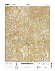
2016 Map of Sanville
USGS Topo · Published 2016About this map
Hogpen Mtn rises in the northwest corner of this Piedmont landscape, overlooking a network of narrow ridges and winding creek valleys along the border of Patrick and Henry Counties. The North Mayo River meanders through the central terrain, its course mirrored by rural routes like Stones Dairy Rd and Co Rd 677. This area maintains a strong connection to its agricultural and community foundations, evidenced by the presence of Old Center Cem and Goodwill Cem, as well as named locales like Stones Store and Stella. The map reveals a settlement pattern of small, dispersed communities such as Pannill Fork and Dillons Fork that sit alongside the waters of Blackberry Cr and Bull Run. This 2016 survey documents the enduring geography of southern Virginia's rural uplands, where family-named roads and small-scale infrastructure like the Trent Farm Airstrip define the local character.
Find a feature on this map
119 named features on this map. Tap any name to fly to it.
Don’t see what you’re looking for? This feature index may not catch every label — zoom into the map to look around manually.
Map Details
Editions of this 2016 Sanville Map
This is the sole edition of this map. No revisions or reprints were ever made.
Other maps of this area

1924 · Martinsville
USGS Topo · 1:48,000

1925 · Rocky Mount
USGS Topo · 1:48,000

1926 · Martinsville
USGS Topo · 1:62,500

1926 · Critz
USGS Topo · 1:48,000

1927 · Rocky Mount
USGS Topo · 1:62,500

1927 · Martinsville
USGS Topo · 1:62,500

1928 · Critz
USGS Topo · 1:62,500

1944 · Martinsville
USGS Topo · 1:62,500

1944 · Rocky Mount
USGS Topo · 1:62,500

1953 · Winston-Salem
USGS Topo · 1:250,000