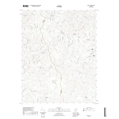
2019 Map of Sanville
USGS Topo · Published 2019About this map
N Mayo River and its numerous tributaries, including Laurel Br and Happy Br, carve through the complex topography along the boundary of Patrick and Henry Counties. This 2019 survey documents the rural character of the region, anchored by historical settlement points like Sanville and Stella. To the north, the elevation rises toward Hogpen Mtn, while the landscape is dotted with small-scale water features like Hales Ponds and the headwaters of Horse Pasture Cr. The presence of the Blue Ridge Airport in the southeast corner indicates modern transportation infrastructure serving this traditionally agricultural and forested area. Genealogists and local historians can locate established landmarks such as Old Center Cem and Goodwill Cem, alongside smaller crossroads communities like Blackberry and Pannill Fork.
Find a feature on this map
123 named features on this map. Tap any name to fly to it.
Don’t see what you’re looking for? This feature index may not catch every label — zoom into the map to look around manually.
Map Details
Editions of this 2019 Sanville Map
This is the sole edition of this map. No revisions or reprints were ever made.
Other maps of this area

1924 · Martinsville
USGS Topo · 1:48,000

1925 · Rocky Mount
USGS Topo · 1:48,000

1926 · Martinsville
USGS Topo · 1:62,500

1926 · Critz
USGS Topo · 1:48,000

1927 · Rocky Mount
USGS Topo · 1:62,500

1927 · Martinsville
USGS Topo · 1:62,500

1928 · Critz
USGS Topo · 1:62,500

1944 · Martinsville
USGS Topo · 1:62,500

1944 · Rocky Mount
USGS Topo · 1:62,500

1953 · Winston-Salem
USGS Topo · 1:250,000