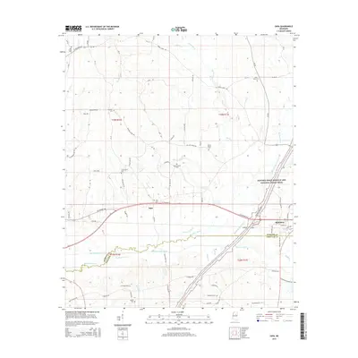
2015 Map of Sapa
USGS Topo · Published 2015About this map
The Big Black River and its parallel Big Black River Canal define the southern landscape of this Webster and Choctaw County border region. The town of Mathiston serves as a local hub near the intersection of major transit corridors, where the modern U S Highway 82 meets the historic route of the Natchez Trace Parkway and National Scenic Trail. This area preserves numerous small family and community burial grounds, including Mount Moriah Cem and La Grange Cem, which provide essential points of reference for genealogical research. The settlement of Sapa is situated centrally along the highway, surrounded by a network of rural routes such as Lollars Grove Rd and Snow Bottom Rd. The drainage patterns of Spring Cr and Pigeon Roost Cr illustrate the managed hydrology of the river basin, contrasting the natural winding creek beds with the engineered canal systems intended for water control.
Find a feature on this map
79 named features on this map. Tap any name to fly to it.
Don’t see what you’re looking for? This feature index may not catch every label — zoom into the map to look around manually.
Map Details
Editions of this 2015 Sapa Map
This is the sole edition of this map. No revisions or reprints were ever made.
Other maps of this area

1953 · Walthall
USGS Topo · 1:62,500

1953 · West Point
USGS Topo · 1:250,000

1958 · West Point
USGS Topo · 1:250,000

1963 · West Point
USGS Topo · 1:250,000

1966 · Tomnolen
USGS Topo · 1:24,000

1968 · Weir
USGS Topo · 1:62,500

1972 · Maben
USGS Topo · 1:24,000

1972 · Sapa
USGS Topo · 1:24,000

1972 · Hohenlinden
USGS Topo · 1:24,000

1972 · Mantee
USGS Topo · 1:24,000