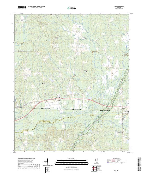
2024 Map of Sapa
USGS Topo · Published 2024About this map
The Big Black River Canal and Old Channel Big Black River dominate the lowlands of southern Webster County, reflecting a landscape heavily modified for drainage and water management. This 2024 survey documents the area around the settlement of Sapa and the western edge of Mathiston, where the Natchez Trace Parkway cuts diagonally through the terrain. The map is particularly rich for family history research, marking numerous burial grounds such as Red Hill African American Cem, Sapa Cem, and Lollars Grove Cem. These cemeteries, often tucked away on rural roads like Co RD 126 or Ticky Bend Rd, offer physical markers of long-established communities in this corner of the Deep South. The transition from the historic winding channel of the river to the straightened canal system illustrates the 20th-century engineering efforts to control the floodplain for agriculture and development.
Find a feature on this map
89 named features on this map. Tap any name to fly to it.
Don’t see what you’re looking for? This feature index may not catch every label — zoom into the map to look around manually.
Map Details
Editions of this 2024 Sapa Map
This is the sole edition of this map. No revisions or reprints were ever made.
Other maps of this area

1953 · Walthall
USGS Topo · 1:62,500

1953 · West Point
USGS Topo · 1:250,000

1958 · West Point
USGS Topo · 1:250,000

1963 · West Point
USGS Topo · 1:250,000

1966 · Tomnolen
USGS Topo · 1:24,000

1968 · Weir
USGS Topo · 1:62,500

1972 · Maben
USGS Topo · 1:24,000

1972 · Sapa
USGS Topo · 1:24,000

1972 · Hohenlinden
USGS Topo · 1:24,000

1972 · Mantee
USGS Topo · 1:24,000