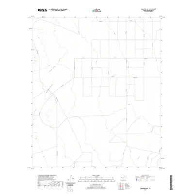
2019 Map of Saragosa NW
USGS Topo · Published 2019About this map
Jones Draw and Ninemile Draw carve paths across this arid Reeves County landscape, reflecting the drainage patterns of the Trans-Pecos region. This 2019 survey captures the area at a time when the desert floor is defined more by its network of county roads and ranching infrastructure than by concentrated settlements. In the southeastern portion, Cherry Cr provides a subtle hydrographic contrast to the more prominent ephemeral draws. The map illustrates a strictly utilitarian grid of secondary transit routes, including Ranch Rd 2903 and Barrilla Rd, which serve the remote rangeland and energy interests of West Texas. These corridors, along with numerous county roads like Co Rd 124 and Co Rd 332, connect the disparate points of the scrubland, marking the modern human imprint on this wide-open terrain.
Find a feature on this map
15 named features on this map. Tap any name to fly to it.
Don’t see what you’re looking for? This feature index may not catch every label — zoom into the map to look around manually.
Map Details
Editions of this 2019 Saragosa NW Map
This is the sole edition of this map. No revisions or reprints were ever made.
Other maps of this area

1921 · Toyah
USGS Topo · 1:125,000

1954 · Pecos
USGS Topo · 1:250,000

1955 · Saragosa
USGS Topo · 1:62,500

1957 · Pecos
USGS Topo · 1:250,000

1970 · Hermosa SW
USGS Topo · 1:24,000

1970 · Florenzo Hill
USGS Topo · 1:24,000

1970 · Toyah
USGS Topo · 1:24,000
1970 · Verhalen South
USGS Topo · 1:24,000
1970 · Saragosa NW
USGS Topo · 1:24,000
1970 · Saragosa
USGS Topo · 1:24,000