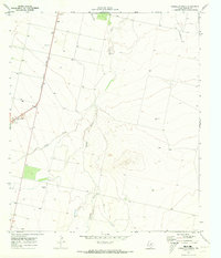
1970 Map of Verhalen South
USGS Topo · Published 1973About this map
Pecos Valley Southern railroad tracks run parallel to the western edge of this 1970 Reeves County landscape, anchoring a sparsely populated agricultural and ranching corridor. The tiny settlement of Verhalen and the nearby Cotton Gin reflect the local economy of the time, while Saragosa sits further south along the rail line. The terrain is defined by the ephemeral drainage of Toyah Creek, Sandia Creek, and Cox Draw, which carve paths through the arid plains toward the Pecos River basin. A scattering of wells and specialized features like a Drill Hole and Gravel Pit suggest the ongoing extraction and water management efforts vital to this West Texas environment. Evidence of livestock management appears at a lone Corral, illustrating the ranching heritage that persisted here even as industrial or utility-related markers began to dot the map.
Find a feature on this map
11 named features on this map. Tap any name to fly to it.
Don’t see what you’re looking for? This feature index may not catch every label — zoom into the map to look around manually.
Map Details
Editions of this 1970 Verhalen South Map
This is the sole edition of this map. No revisions or reprints were ever made.
Other maps of this area

1894 · Fort Davis
USGS Topo · 1:125,000

1897 · Fort Davis
USGS Topo · 1:125,000

1921 · Toyah
USGS Topo · 1:125,000

1929 · Hovey
USGS Topo · 1:125,000

1931 · Barstow
USGS Topo · 1:125,000

1954 · Pecos
USGS Topo · 1:250,000

1954 · Fort Stockton
USGS Topo · 1:250,000

1955 · Saragosa
USGS Topo · 1:62,500

1957 · Pecos
USGS Topo · 1:250,000

1958 · Fort Stockton
USGS Topo · 1:250,000