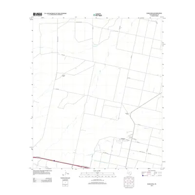
2013 Map of Saragosa
USGS Topo · Published 2013About this map
Saragosa serves as the primary hub of this West Texas landscape, where the grid of town streets like Maha St and W Main St meets the open desert. The settlement’s connectivity is defined by its position along the railroad at Saragosa Siding and its proximity to the life-giving waters of the Reeves County Water Improvement Canal. This irrigation infrastructure is a critical component of the local geography, cutting a straight line across the southern portion of the map and redirecting water through an otherwise arid environment.
Find a feature on this map
26 named features on this map. Tap any name to fly to it.
Don’t see what you’re looking for? This feature index may not catch every label — zoom into the map to look around manually.
Map Details
Editions of this 2013 Saragosa Map
This is the sole edition of this map. No revisions or reprints were ever made.
Other maps of this area

1894 · Fort Davis
USGS Topo · 1:125,000

1897 · Fort Davis
USGS Topo · 1:125,000

1921 · Toyah
USGS Topo · 1:125,000

1954 · Pecos
USGS Topo · 1:250,000

1954 · Fort Stockton
USGS Topo · 1:250,000

1955 · Saragosa
USGS Topo · 1:62,500

1957 · Pecos
USGS Topo · 1:250,000

1958 · Fort Stockton
USGS Topo · 1:250,000

1970 · Florenzo Hill
USGS Topo · 1:24,000
1970 · Verhalen South
USGS Topo · 1:24,000