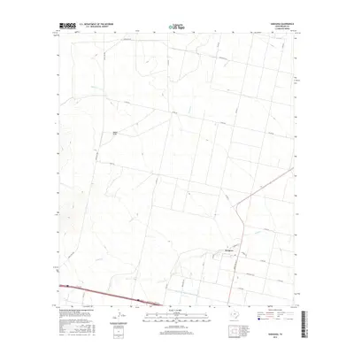
2016 Map of Saragosa
USGS Topo · Published 2016About this map
Saragosa sits at the intersection of local routes and natural watercourses, serving as a focal point in this Trans-Pecos landscape. The settlement is defined by a grid of streets including Iglesia St and Parede St, situated just north of the Reeves County Water Improvement Canal. This irrigation infrastructure illustrates the critical role of water management in the region's agricultural development. The surrounding terrain is marked by seasonal drainages such as Toyah Cr, Cherry Cr, and Canyon Cr, which converge near the town. North of the community, Adobe Draw provides a distinctive topographical landmark amidst a network of ranch roads like Ranch Rd 3334 and Ranch Rd 2903 that connect the remote cattle country and local homesteads.
Find a feature on this map
22 named features on this map. Tap any name to fly to it.
Don’t see what you’re looking for? This feature index may not catch every label — zoom into the map to look around manually.
Map Details
Editions of this 2016 Saragosa Map
This is the sole edition of this map. No revisions or reprints were ever made.
Other maps of this area

1894 · Fort Davis
USGS Topo · 1:125,000

1897 · Fort Davis
USGS Topo · 1:125,000

1921 · Toyah
USGS Topo · 1:125,000

1954 · Pecos
USGS Topo · 1:250,000

1954 · Fort Stockton
USGS Topo · 1:250,000

1955 · Saragosa
USGS Topo · 1:62,500

1957 · Pecos
USGS Topo · 1:250,000

1958 · Fort Stockton
USGS Topo · 1:250,000

1970 · Florenzo Hill
USGS Topo · 1:24,000
1970 · Verhalen South
USGS Topo · 1:24,000