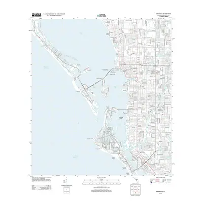
2012 Map of Sarasota
USGS Topo · Published 2012About this map
Sarasota Bay dominates this coastal survey, where a complex network of keys and inlets protects the mainland shoreline. The urban center of Sarasota is anchored by Main St and Ringling Blvd, with the Ringling Bridge providing a vital connection to Bird Key and the upscale developments of Saint Armands. The geography here is defined by water, from the narrow passage of New Pass to the broad reach of Big Sarasota Pass, which separates Lido Key from the northern tip of Siesta Key. Along the mainland, residential expansion is evident in neighborhoods like Indian Beach and near Sarasota Memorial Park. The map also captures maritime infrastructure including Payne Terminal and the Tony Saprito Fishing Pier North Light, illustrating the city's deep integration with the Gulf of Mexico.
Find a feature on this map
44 named features on this map. Tap any name to fly to it.
Don’t see what you’re looking for? This feature index may not catch every label — zoom into the map to look around manually.
Map Details
Editions of this 2012 Sarasota Map
This is the sole edition of this map. No revisions or reprints were ever made.
Other maps of this area

1943 · Laurel
USGS Topo · 1:24,000

1944 · Bird Keys
USGS Topo · 1:31,680

1944 · Sarasota
USGS Topo · 1:31,680

1944 · Laurel
USGS Topo · 1:31,680

1944 · Lorraine
USGS Topo · 1:31,680

1944 · Bradenton Beach
USGS Topo · 1:31,680

1947 · Bradenton
USGS Topo · 1:24,000

1947 · Bee Ridge
USGS Topo · 1:24,000

1956 · Tampa
USGS Topo · 1:250,000

1959 · Tampa
USGS Topo · 1:250,000