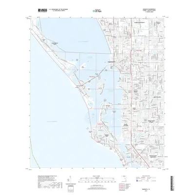
2018 Map of Sarasota
USGS Topo · Published 2018About this map
Sarasota sits at the heart of this coastal study, where the mainland grid meets the complex island geography of Sarasota Bay. This era of the city's development is defined by a sophisticated network of bridges and causeways, such as the John Ringling Blvd connecting Golden Gate Point to Bird Key and the island chain beyond. The map illustrates the dense residential growth of neighborhoods like Southgate and Ridge Wood Heights, while preserving the distinct footprints of long-established institutions such as the Ringling College of Art and Design and the Sarasota Memorial Park.
Find a feature on this map
68 named features on this map. Tap any name to fly to it.
Don’t see what you’re looking for? This feature index may not catch every label — zoom into the map to look around manually.
Map Details
Editions of this 2018 Sarasota Map
This is the sole edition of this map. No revisions or reprints were ever made.
Other maps of this area

1943 · Laurel
USGS Topo · 1:24,000

1944 · Bird Keys
USGS Topo · 1:31,680

1944 · Sarasota
USGS Topo · 1:31,680

1944 · Laurel
USGS Topo · 1:31,680

1944 · Lorraine
USGS Topo · 1:31,680

1944 · Bradenton Beach
USGS Topo · 1:31,680

1947 · Bradenton
USGS Topo · 1:24,000

1947 · Bee Ridge
USGS Topo · 1:24,000

1956 · Tampa
USGS Topo · 1:250,000

1959 · Tampa
USGS Topo · 1:250,000