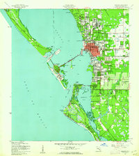
1944 Map of Sarasota
USGS Topo · Published 1961About this map
Sarasota stands as a burgeoning coastal hub on the eve of post-war expansion, its downtown core concentrated east of Sarasota Bay. This 1940s landscape is defined by the ambitious infrastructure connecting the mainland to the barrier islands, most notably the Ringling Causeway which links the city to St Armand Key and Coon Key. To the north, the Sarasota Municipal Airport and the Booker Schs mark the edges of residential growth, while the waterfront reflects a working maritime economy at Payne Terminal and Fishery Point. The inland reaches show the paths of the Atlantic Coast Line and Seaboard Air Line railroads, which facilitated the region's winter tourism and agricultural exports. South of the city center, the terrain transitions into the residential pockets of Sarasota Heights and the intricate waterways of Phillippi Creek and Roberts Bay.
Find a feature on this map
42 named features on this map. Tap any name to fly to it.
Don’t see what you’re looking for? This feature index may not catch every label — zoom into the map to look around manually.
Map Details
Editions of this 1944 Sarasota Map
2 editions found
Other maps of this area

1943 · Laurel
USGS Topo · 1:24,000

1944 · Bird Keys
USGS Topo · 1:31,680

1944 · Sarasota
USGS Topo · 1:31,680

1944 · Laurel
USGS Topo · 1:31,680

1944 · Lorraine
USGS Topo · 1:31,680

1944 · Bradenton Beach
USGS Topo · 1:31,680

1947 · Bradenton
USGS Topo · 1:24,000

1947 · Bee Ridge
USGS Topo · 1:24,000

1956 · Tampa
USGS Topo · 1:250,000

1959 · Tampa
USGS Topo · 1:250,000