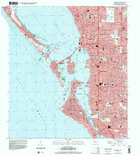
1994 Map of Sarasota
USGS Topo · Published 2000About this map
The barrier islands of Long Boat Key, Lido Key, and Siesta Key form a complex coastal landscape in this mid-1990s look at the Gulf Coast. Separating the open Gulf of Mexico from the inner reaches of Sarasota Bay and Roberts Bay, these keys are connected by a network of bridges and causeways, including the Ringling Blvd crossing to St Armands Key. The map reveals the intricate development of residential canals and fingers, particularly around Grand Canal and the northern tip of Siesta Key at Sarasota Point.
Find a feature on this map
80 named features on this map. Tap any name to fly to it.
Don’t see what you’re looking for? This feature index may not catch every label — zoom into the map to look around manually.
Map Details
Editions of this 1994 Sarasota Map
This is the sole edition of this map. No revisions or reprints were ever made.
Other maps of this area

1943 · Laurel
USGS Topo · 1:24,000

1944 · Bird Keys
USGS Topo · 1:31,680

1944 · Sarasota
USGS Topo · 1:31,680

1944 · Laurel
USGS Topo · 1:31,680

1944 · Lorraine
USGS Topo · 1:31,680

1944 · Bradenton Beach
USGS Topo · 1:31,680

1947 · Bradenton
USGS Topo · 1:24,000

1947 · Bee Ridge
USGS Topo · 1:24,000

1956 · Tampa
USGS Topo · 1:250,000

1959 · Tampa
USGS Topo · 1:250,000