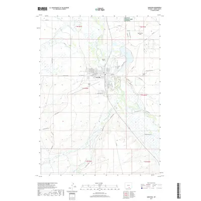
2017 Map of Saratoga
USGS Topo · Published 2017About this map
Saratoga serves as the focal point of this Carbon County region, situated along the banks of the North Platte River. The town's grid is well-defined by a network of streets including W Main Ave and W Bridge Ave, leading toward the river and Mullison Island. The landscape is a complex system of water management and natural features, characterized by numerous irrigation channels like the Hugus Mullison Ditch and Pick Ditch that support the surrounding valley. To the northeast, the Saratoga National Fish Hatchery and Saratoga Lake highlight the area's specialized land use and water resources.
Find a feature on this map
74 named features on this map. Tap any name to fly to it.
Don’t see what you’re looking for? This feature index may not catch every label — zoom into the map to look around manually.
Map Details
Editions of this 2017 Saratoga Map
This is the sole edition of this map. No revisions or reprints were ever made.
Other maps of this area

1893 · Fort Steele
USGS Topo · 1:125,000

1939 · Saratoga
USGS Topo · 1:125,000

1954 · Rawlins
USGS Topo · 1:250,000

1955 · Overland
USGS Topo · 1:24,000

1955 · Overland Crossing
USGS Topo · 1:24,000

1955 · Oberg Ranch
USGS Topo · 1:24,000

1958 · Rawlins
USGS Topo · 1:250,000
1961 · Finley Reservoir
USGS Topo · 1:24,000
1961 · Saratoga
USGS Topo · 1:24,000
1961 · Cow Creek Ranch
USGS Topo · 1:24,000