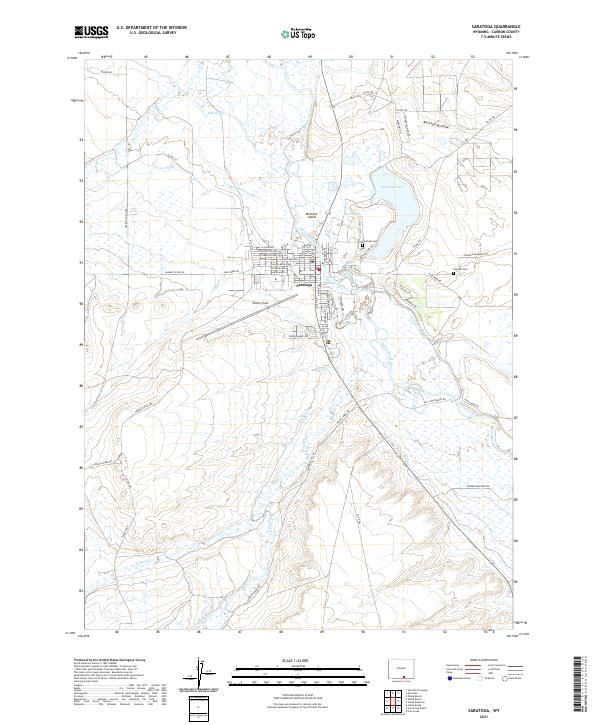
2021 Map of Saratoga
USGS Topo · Published 2021About this map
The North Platte River defines the landscape of Saratoga, creating a complex network of waterways including Hot Slough, Cadwell Slough, and the prominent Mullison Island. This 2021 survey details a community deeply connected to its hydrology, where agricultural infrastructure like Pick Ditch and Hugus Mullison Ditch divert water across the flats toward Saratoga Lake. The town itself is flanked by essential landmarks, from the thermal waters at Saratoga Hot Springs to the regional aviation hub at Shively Field.
Find a feature on this map
74 named features on this map. Tap any name to fly to it.
Don’t see what you’re looking for? This feature index may not catch every label — zoom into the map to look around manually.
Map Details
Editions of this 2021 Saratoga Map
This is the sole edition of this map. No revisions or reprints were ever made.
Other maps of this area

1893 · Fort Steele
USGS Topo · 1:125,000

1939 · Saratoga
USGS Topo · 1:125,000

1954 · Rawlins
USGS Topo · 1:250,000

1955 · Overland
USGS Topo · 1:24,000

1955 · Overland Crossing
USGS Topo · 1:24,000

1955 · Oberg Ranch
USGS Topo · 1:24,000

1958 · Rawlins
USGS Topo · 1:250,000
1961 · Finley Reservoir
USGS Topo · 1:24,000
1961 · Saratoga
USGS Topo · 1:24,000
1961 · Cow Creek Ranch
USGS Topo · 1:24,000