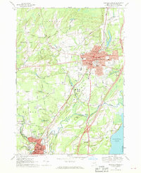
1967 Map of Saratoga Springs
USGS Topo · Published 1969About this map
Saratoga Springs and Ballston Spa serve as the primary hubs in this late-1960s survey, illustrating a region defined by its therapeutic waters and thoroughbred racing culture. The map captures the extensive grounds of Saratoga Spa State Park and the Saratoga Racetrack, alongside the academic footprint of Skidmore College. The landscape is etched by the Delaware and Hudson railroad and numerous waterways including Kayaderosseras Creek and the Mourning Kill.
Find a feature on this map
67 named features on this map. Tap any name to fly to it.
Don’t see what you’re looking for? This feature index may not catch every label — zoom into the map to look around manually.
Map Details
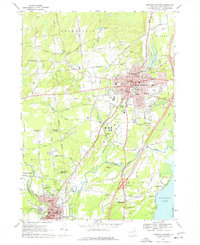
Editions of this 1967 Saratoga Springs Map
2 editions found
Other maps of this area

1893 · Cohoes
USGS Topo · 1:62,500

1893 · Schenectady
USGS Topo · 1:62,500

1895 · Cohoes
USGS Topo · 1:62,500

1895 · Schenectady
USGS Topo · 1:62,500

1898 · Schenectady
USGS Topo · 1:62,500

1898 · Cohoes
USGS Topo · 1:62,500

1900 · Schuylerville
USGS Topo · 1:62,500

1902 · Saratoga
USGS Topo · 1:62,500

1929 · Cohoes
USGS Topo · 1:62,500

1930 · Schenectady
USGS Topo · 1:62,500