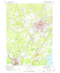
1967 Map of Saratoga Springs
USGS Topo · Published 1977About this map
Saratoga Springs centers this 1960s landscape, defined by its historic mineral springs and celebrated racing heritage. The map documents a sophisticated resort culture, featuring the Saratoga Racetrack, the Oklahoma Racetrack, and the nearby Saratoga Raceway. To the southeast, the artist colony of Yaddo sits adjacent to the sprawling Saratoga State Park, where Geyser Brook winds through the grounds. This era shows the city as a thriving educational and cultural hub, anchored by Skidmore College and the preservation of historic sites like High Rock Spring.
Find a feature on this map
71 named features on this map. Tap any name to fly to it.
Don’t see what you’re looking for? This feature index may not catch every label — zoom into the map to look around manually.
Map Details
Editions of this 1967 Saratoga Springs Map
2 editions found
Other maps of this area

1893 · Cohoes
USGS Topo · 1:62,500

1893 · Schenectady
USGS Topo · 1:62,500

1895 · Cohoes
USGS Topo · 1:62,500

1895 · Schenectady
USGS Topo · 1:62,500

1898 · Schenectady
USGS Topo · 1:62,500

1898 · Cohoes
USGS Topo · 1:62,500

1900 · Schuylerville
USGS Topo · 1:62,500

1902 · Saratoga
USGS Topo · 1:62,500

1929 · Cohoes
USGS Topo · 1:62,500

1930 · Schenectady
USGS Topo · 1:62,500