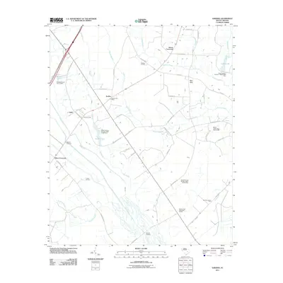
2011 Map of Sardinia
USGS Topo · Published 2011About this map
Sardinia and the surrounding Clarendon County countryside are defined by a network of slow-moving watercourses and small agricultural settlements. The Black River winds through the southern portion of the landscape, joined by numerous tributaries including Mill Branch, Newman Branch, and Breakfast Branch. This 2011 survey documents a community infrastructure anchored by the Sardinia Post Office and Gable Post Office, alongside several historic gathering points like Beards Crossroads and Wilson Crossroads.
Find a feature on this map
51 named features on this map. Tap any name to fly to it.
Don’t see what you’re looking for? This feature index may not catch every label — zoom into the map to look around manually.
Map Details
Editions of this 2011 Sardinia Map
This is the sole edition of this map. No revisions or reprints were ever made.
Other maps of this area

1920 · Mayesville
USGS Topo · 1:48,000

1920 · Manning
USGS Topo · 1:48,000

1921 · Manning
USGS Topo · 1:62,500

1921 · Mayesville
USGS Topo · 1:62,500

1943 · Mayesville
USGS Topo · 1:62,500

1944 · Manning
USGS Topo · 1:62,500

1946 · Kingstree
USGS Topo · 1:62,500

1946 · Lake City
USGS Topo · 1:62,500

1949 · Georgetown
USGS Topo · 1:250,000

1954 · Augusta
USGS Topo · 1:250,000