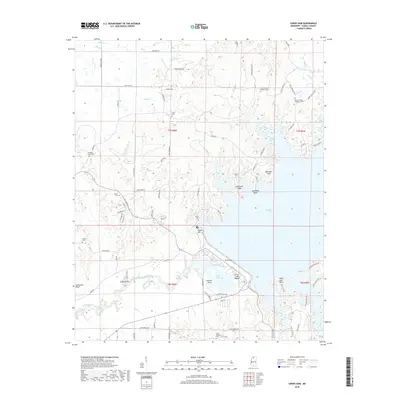
2018 Map of Sardis Dam
USGS Topo · Published 2018About this map
The Sardis Dam creates a massive geographic division in Panola County, holding back the expansive Sardis Lake and altering the course of the Little Tallahatchie River. This modern topographically detailed view shows the high ridges and points that define the reservoir's western edge, including Cemetery Ridge, Moccasin Point, and Lespideza Point. South of the dam, the topography drops toward the Lower Lake and its associated Lower Lake Beach, while the river continues past Floyds Island and Jonathans Bluff. The landscape is dotted with rural history, evidenced by a high density of small burial grounds like Simon Chapel Number 1 Cem and Simon Chapel Number 2 Cem, which represent the original communities that predate the mid-century water management projects.
Find a feature on this map
78 named features on this map. Tap any name to fly to it.
Don’t see what you’re looking for? This feature index may not catch every label — zoom into the map to look around manually.
Map Details
Editions of this 2018 Sardis Dam Map
This is the sole edition of this map. No revisions or reprints were ever made.
Other maps of this area

1940 · Oxford
USGS Topo · 1:62,500

1943 · Oxford
USGS Topo · 1:62,500

1944 · Senatobia
USGS Topo · 1:62,500

1944 · Tyro
USGS Topo · 1:62,500

1952 · Sardis
USGS Topo · 1:62,500

1953 · Sardis
USGS Topo · 1:62,500

1956 · Tupelo
USGS Topo · 1:250,000

1958 · Tupelo
USGS Topo · 1:250,000
1971 · Tyro
USGS Topo · 1:24,000
1975 · Senatobia SW
USGS Topo · 1:24,000