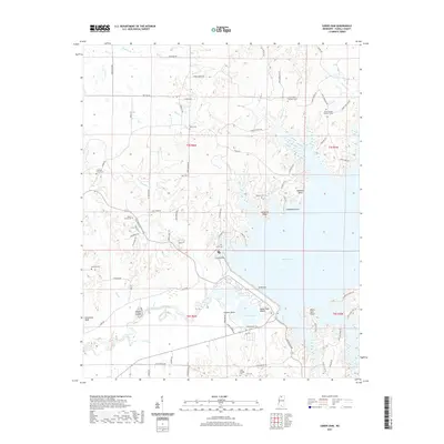
2021 Map of Sardis Dam
USGS Topo · Published 2021About this map
Sardis Dam dominates the central landscape of this Panola County study, controlling the waters of the Little Tallahatchie River and creating the expanse of Sardis Lake. This 2021 topographic record reveals the intricate shoreline of the reservoir, punctuated by landforms like Cemetery Ridge, Moccasin Point, and Lespideza Point. South of the dam, the terrain transitions into the Lower Lake recreation area, including Lower Lake Beach and Cypress Point.
Find a feature on this map
83 named features on this map. Tap any name to fly to it.
Don’t see what you’re looking for? This feature index may not catch every label — zoom into the map to look around manually.
Map Details
Editions of this 2021 Sardis Dam Map
This is the sole edition of this map. No revisions or reprints were ever made.
Other maps of this area

1940 · Oxford
USGS Topo · 1:62,500

1943 · Oxford
USGS Topo · 1:62,500

1944 · Senatobia
USGS Topo · 1:62,500

1944 · Tyro
USGS Topo · 1:62,500

1952 · Sardis
USGS Topo · 1:62,500

1953 · Sardis
USGS Topo · 1:62,500

1956 · Tupelo
USGS Topo · 1:250,000

1958 · Tupelo
USGS Topo · 1:250,000
1971 · Tyro
USGS Topo · 1:24,000
1975 · Senatobia SW
USGS Topo · 1:24,000