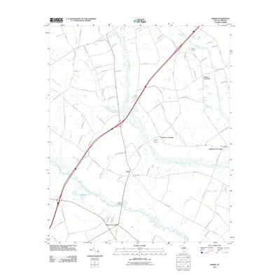
2011 Map of Sardis
USGS Topo · Published 2011About this map
The settlement of Sardis serves as a central point in this rural Florence County landscape, where agriculture and hydrology define the community structure. The terrain is deeply influenced by the meandering Lynches River and its accompanying wetlands, including Sparrow Swamp and Deep Hole Swamp. These water systems create a distinct pattern of road development, with numerous family-named junctions such as Sansbury Crossroads and Sparrows Crossroads appearing where travel routes skirt the lowlands.
Find a feature on this map
83 named features on this map. Tap any name to fly to it.
Don’t see what you’re looking for? This feature index may not catch every label — zoom into the map to look around manually.
Map Details
Editions of this 2011 Sardis Map
This is the sole edition of this map. No revisions or reprints were ever made.
Other maps of this area

1920 · Mayesville
USGS Topo · 1:48,000

1921 · Mayesville
USGS Topo · 1:62,500

1940 · Florence West
USGS Topo · 1:62,500

1941 · Spartanburg
USGS Topo · 1:250,000

1943 · Mayesville
USGS Topo · 1:62,500

1945 · Florence West
USGS Topo · 1:62,500

1946 · Lake City
USGS Topo · 1:62,500

1949 · Georgetown
USGS Topo · 1:250,000

1953 · Florence
USGS Topo · 1:250,000

1953 · Spartanburg
USGS Topo · 1:250,000