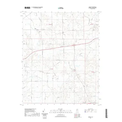
2021 Map of Sardis SE
USGS Topo · Published 2021About this map
Terza serves as a focal point in this portion of Panola County, where the rural landscape is defined by its numerous small burial grounds and winding watercourses. This contemporary survey records several local cemeteries including Mount Gillian Cem, Mount Terza Cem, and Bluff Springs Cem, which provide essential touchpoints for genealogical research in the area. The terrain is deeply carved by a network of drainage systems, most notably Hotopha Cr, Johnson Cr, and Bynum Cr, while Lone Lake sits near the southern edge. A complex web of secondary roads such as Central Academy Rd and Fudgetown Rd connects scattered residences and community sites, reflecting the persistent rural settlement pattern of northern Mississippi. Nearby, Forest Memorial Park stands as a more modern landmark amidst these traditional farm-to-market routes and historic creek valleys.
Find a feature on this map
76 named features on this map. Tap any name to fly to it.
Don’t see what you’re looking for? This feature index may not catch every label — zoom into the map to look around manually.
Map Details
Editions of this 2021 Sardis SE Map
This is the sole edition of this map. No revisions or reprints were ever made.
Other maps of this area

1940 · Oxford
USGS Topo · 1:62,500

1943 · Oxford
USGS Topo · 1:62,500

1952 · Sardis
USGS Topo · 1:62,500

1953 · Sardis
USGS Topo · 1:62,500

1954 · Oakland
USGS Topo · 1:62,500

1954 · Water Valley
USGS Topo · 1:62,500

1954 · Water Valley West
USGS Topo · 1:24,000

1955 · Water Valley
USGS Topo · 1:62,500

1956 · Tupelo
USGS Topo · 1:250,000

1958 · Tupelo
USGS Topo · 1:250,000