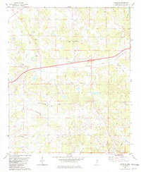
1982 Map of Sardis SE
USGS Topo · Published 1982About this map
A landscape defined by small rural hubs and a dense network of watercourses characterizes this Panola County terrain during the early 1980s. The settlement of Bluff Springs sits centrally, while Central Academy and Concord serve as focal points for the surrounding agricultural community. The map reveals a remarkably dense concentration of local houses of worship, ranging from St Peter Ch in the north to Good Hope Ch in the south, suggesting a deeply rooted community structure. Many of these churches, such as Mt Gillion Ch and Mt Terza Ch, are positioned along the ridges between the numerous creek valleys that drain the region.
Find a feature on this map
37 named features on this map. Tap any name to fly to it.
Don’t see what you’re looking for? This feature index may not catch every label — zoom into the map to look around manually.
Map Details
Editions of this 1982 Sardis SE Map
This is the sole edition of this map. No revisions or reprints were ever made.
Other maps of this area

1940 · Oxford
USGS Topo · 1:62,500

1943 · Oxford
USGS Topo · 1:62,500

1952 · Sardis
USGS Topo · 1:62,500

1953 · Sardis
USGS Topo · 1:62,500

1954 · Oakland
USGS Topo · 1:62,500

1954 · Water Valley
USGS Topo · 1:62,500

1954 · Water Valley West
USGS Topo · 1:24,000

1955 · Water Valley
USGS Topo · 1:62,500

1956 · Tupelo
USGS Topo · 1:250,000

1958 · Tupelo
USGS Topo · 1:250,000